East Pilbara Lithium Project
Location
The prospects are situated 200 km east of Port Hedland, and 30km east and south-east of Marble Bar in the East Pilbara region of Western Australia and cover a large area of approximately 369 km2
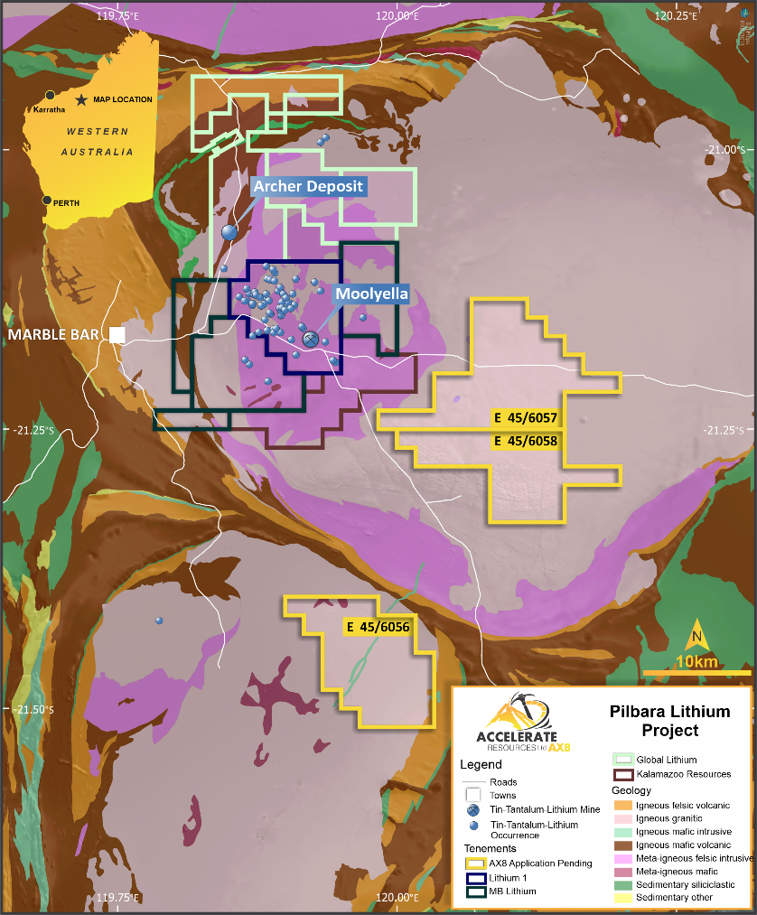 Figure 1: Location Map – East Pilbara Lithium Applications
Local Geology
Applications E45/6057 (~146 km2) and E45/6058 (~103km2) cover the central eastern section of the Mt Edgar Batholith, a prominent granitic intrusion with N-S and N-E lineaments and structures identified from broad based Geological Survey data.
Application E45/6056 (120km2) covers the north-east section of the Corunna Downs Batholith with prominent N-S, E-W and NE lineaments and structures identified from broad based Geological Survey data.
Both areas are underexplored for lithium minerals but have been the subject of limited historic diamond exploration and historic tin and tantalite exploration activity.
Planned program
The Company plans to conduct initial reconnaissance activity including geological mapping and selective surface sampling as well as detailed desk top assessment over the coming months with a view to generating target areas.

